Tuesday, March 24, 2015

How Mount Fitz Roy and Cerro Torre Ruined Us


The iconic Ruta 40 in Argentina runs mostly parallel to the Andes mountains. In the south, it takes you to the sparsely populated regions of Patagonia through flat, boring, and WINDY land for hundreds of miles. It has been recently paved, which saved us DAYS of driving. We picked up Ruta 40 after our brief but incredible exploration of the Chilean version of Ruta 40, the Carretera Austral (previous blog post).

When I say that this route is WINDY, I can't emphasize it enough. The ice caps in the west and the warm plains in the east create a thermal gradient that causes T H E  M O S T intense wind we have ever experienced. During some of our hikes over the following three weeks I would find myself hiking on all fours (on flat ground) so as not to get knocked to the ground by a gust of wind. Unfortunately, the wind also caused many sleepless nights while it tested the structural integrity of El Tigre.


It's so windy, they have a special sign for it

But, this blog post isn't really about Ruta 40 or the wind. It's about our favorite place in South America - Parque Nacional Los Glaciares. This national park covers such a massive area that it has 2 sectors. The sectors are a 125-mile drive apart but as the crow flies, only 60 miles. Our favorite sector contains the iconic Mount Fitz Roy (of Patagonia logo fame) and Cerro Torre, among many other impressive spires. It all starts with a view of the mountain range that gets better and better as you drive straight at it for 50 miles (pictures below).

Our first sighting of the spires. Despite the piercing, cold wind, you can't help but get out to take a picture.

The view from far, far away on the road in, is still mind-blowing. The whole drive, you're thinking, "we're going there!?!"

Not to bore you with too much detail, I will briefly explain why we loved this area. The scenery is breathtaking. Views of these mountains never get old. We did the popular hike to the base of Mount Fitz Roy twice, and if the weather would've cooperated, we would've done it again. We did three less popular hikes that also offered world class views. Since we didn't have camping gear, we only did day trips, which limited what we could see, and also limited the lighting for pictures. The pictures definitely don't capture it all.

Here we come, Mount Fitz Roy!


The tallest peak is Mount Fitz Roy and is successfully climbed about once a year
(despite many attempts by EXPERT rock climbers)

This sector of the park is completely FREE. It blows our minds. The ranger suggested that it was because there was a town in the park (El Chalten) and the logistics of charging people was too hard. That seems like a weird explanation, given that Parque Nacional Los Alerces has no problem managing this issue. Listen to us, complaining about a FREE national park! That is how much we loved this area. It's the kind of place you want to support.


Lunch with a million dollar view

The best part is that this sector is not commercialized. There are no campgrounds selling beer and pizza along the trail, no fancy lodges, NO HORSE EXCREMENT ON THE TRAILS, and no roads - just mother nature and the people who love her. We overheard people in the visitor center asking if they could drive to some viewpoints, but to see the goods, you've gotta hike to them - no shortcuts. We were so impressed with some of the people hiking these trails - old, young, ill equipped, out-of-shape - they all wanted the goods and they worked their asses off for it. Despite the knee-busting climbs and knock-down wind, almost everyone hiking the trails seemed happy.

Lago Torre and Glacier Grande with the star of the show (Cerro Torre) hiding behind the clouds.
Check out that little blue lake in the bottom right of the picture

In-spiring (did you think we'd get through this post without saying it?)

We felt the pull of this place so strongly that we visited twice. As we drove away, it hurt a little knowing that we probably wouldn't be back anytime soon. We are ruined after visiting these mountains. Will anything ever be able to compare? We won't stop looking...


Saturday, March 14, 2015

A Little Slice Of Awesomeness on the Carretera Austral, Chile

If you had asked me a year ago what the "Carretera Austral" was, I would've only been able to tell you that it is a rough road that many-a-overlander have written about. I didn't know that it was in Chile (vs. Argentina) nor that it means "South Road", providing access to the southwestern-most reaches of Chilean Patagonia (the really southern parts of Chile can only be accessed by boat or going through Argentina). Building the Carretera Austral must have been pretty complicated given the many ocean inlets, lakes, mountains, rivers, and the seemingly impenetrable rain forest.

These Nalca plants (giant rhubarb) contribute to the impenetrable nature of the area

Old road on the right, new road on the left

Sections of the Carretera Austral have only recently opened (2003), and today, it is in the process of being paved. We scored by being able to drive on some fresh pavement (aaaand some really crappy, rough road) through some of the most beautiful and unspoiled areas in southwest Chile. Truth be told, we stopped when the road got really rough, never making it down the last 280 miles. We were so wowed by the glaciers and hikes that we're going to do this route again when we head north.

Exploration comes at a cost

We crossed into Chile from Argentina to pick up the Carretera Austral near Futuleufu (try saying that with a mouth full of cookies). On our way, we passed a huge lake, Lago Yelcho, that had no easy public access.  It was so blue, calm, and clear, that we stopped on the side of the narrow dirt road to have a look. While we were enjoying the view, Scott spotted a giant brown trout swimming near the surface. Before I knew it, he had scrambled down the precarious hillside, fishing pole in hand.
 
Lago Yelcho and an unsuccessful fisherman

Our stop for the night was near the Ventisquero Yelcho (Yelcho Glacier), which is the source of water for this giant lake. The next morning we hiked to the glacier.

Our hike to Ventisquero Yelcho. Scott's words, "I wouldn't like this trail even if I was 4 feet tall". We eventually just walked up the stream.

We didn't anticipate that we'd be able to scramble over the rocks right up to the edge of the glacier. Glacial ice has a distinctive blue tint that, at certain angles, seems unnatural.

Excited to get right to the edge, I climbed up and up, later realizing that the way down would be quite scary and treacherous. Scott stood below, safely taking pictures.

We did not realize how dangerous it was for us to eat lunch on the rocks, right next to the glacier, until we heard and felt a thunderous rumble and realized we could be pounded by falling rocks and ice at any moment. Duh.

Ventisquero Yelcho runs down the mountain for miles. This picture only captures the very edge where we ate lunch.

As we would later learn, climbing right up to the face of a glacier is not the norm. At our next stop, Colgante glacier, in Quelat National Park, access is limited to a boat ride or distant lookouts. Both of the lookouts were packed with 20-something boys, drinking beer, and chatting like it was a nightclub (I guess we had bad timing on our visit). You will notice, in the picture below, how the access to the famous Colgante glacier pales in comparison with the lesser known Yelcho glacier.

Despite the far away viewpoint, the waterfall coming off Ventisquero Colgante was quite impressive.
The boat ride (that we didn't take) may have been worth it.

Hidden right off the highway, is a short, steep hike to yet another glacier called Bosque Encantado (Enchanted Forest). The star of the show was the warm day and the icy, glacier-fed lake that we swam in (briefly!). Pictures below.

Bosque Encantado

Scott winding up for a jump - eeeee it's going to be cold!

Evidence that even I took the plunge

Scott bravely jumped into the icy waters twice - good man!

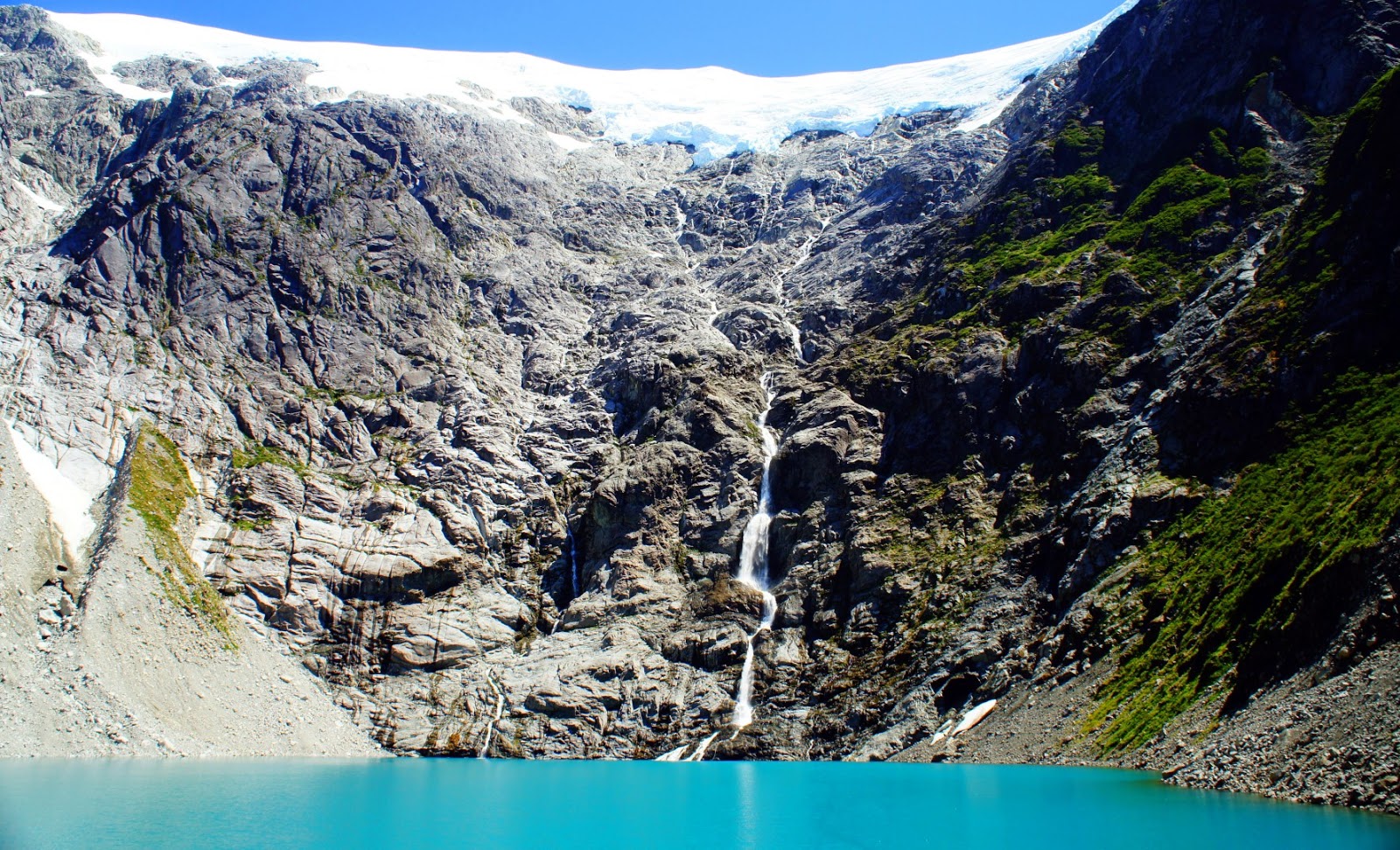
The last bit of adventuring we did along the Carretera Austral was without a doubt our favorite. A hike contained within the Cerro Castillo (Castle Peak) National Reserve took us up to a stunning, turquoise, almost toxic-looking lake, fed by a very impressive glacier. The best part is that we had NO IDEA that the lake would be so overwhelmingly cool. The mountain range itself would've been enough to make the hike our favorite. We smiled from ear-to-ear when we crested the ridge to see the lake below. Pictures below.


This is a diagonal panorama as we were trying to capture the mountain and the lake all in one

The lake changed colors when we climbed down closer to the shore

We are nearing the end of our journey south and things just couldn't be better. Stayed tuned for the star attractions of Patagonia!

The area that this post covers

Tuesday, February 24, 2015

The Lakes District, Argentina - Paddleboarding Legally

The Lakes District of Argentina continued to entertain and wow us as we headed south. We hiked some big peaks, and again found they were covered in a layer of deep ash due to the 2011 eruption of Volcan Puyehue. While we were hiking to a peak known as Cerro Belvedere, the wind was so strong that clouds of ash filled the distant sky. We eventually had to turn around because of the ash in our eyes and mouths. On the plus side, our faces were baby-butt smooth from the exfoliation treatment.

The view from Cerro Belvedere of a small section of  Lago Nauhuel Huapi the largest lake in the region - 60 miles long!!!


Outside of the large town of Bariloche, we drove up a long, slow, painfully pot-holed road to visit Mt. Tronador and the large glacier creeping down its slopes. It was our first glacier in South America, so we were excited to see it in action. From our camp spot, we could hear the thundering echo of the ice breaking off the glacier. At the viewpoint, we spent the entire day viewing the icebergs in the lake change shape and hoping to see/hear pieces of the glacier crash into the lake. We got a thumbs up from one of the rangers when we set up our camp chairs on a little knoll overlooking the glacier. The only time the glacier made a move was when we were eating lunch INSIDE THE TRUCK!!  We heard it, and later saw the violent-looking aftermath in the lake. DAMMIT! Pictures below.

Our camping spot below Mt. Tronador. Cheers to the best television screen nature can offer.

Our viewpoint for the entire day overlooking the Tronador glacier - the glacier is brown because of all the rocks on it's surface

Spoiler alert: now that we are in the heart of Patagonia and all of it's huge glaciers, our day at Tronador seems kind of silly. Oh well, it was still fun.

Continuing south, the town of El Bolson had been on our list for a while after we learned that it is the microbrew capital of Argentina. They grow 3/4 of all the hops IN THE ENTIRE COUNTRY. To say the least, we had some beers! The region boasts a warm micro climate that not only grows hops, but also abundant produce including big juicy berries of all sorts. We spent a day outside the town cooling off in the sparkling, turquoise water of the Rio Azul pictured below.

Rio Azul: This swimming hole was called "El Paraiso" (The Paradise)

Rio Azul: A contrast in temperatures.
After getting up the nerve to jump into the icy waters, I had to bake myself a bit before heading back to shore

A little further south in Alerces National Park we put our paddleboards to work - and it was legal this time! With a little foot work, we found that we could paddleboard between the lakes on crystalline, trout-choked rivers. We were so stoked when our strategy worked out the first day: we locked up the paddleboards and gear at our camping spot, drove the truck about 6 miles to the next camping spot, ran back to our paddleboards, then paddleboarded back to the truck. We repeated this process on 2 more rivers without a hitch. Pictures below.

This river was teaming with giant rainbow and brown trout

The viewpoint during our hike back to the truck: the lake and river we were about to paddleboard (we were excited!)

Scott never passes up a "jumping rock"

Swimming with the trout

Next up, back into Chile for some very impressive glaciers among other things...

Wednesday, February 18, 2015

The Lakes District, Argentina - A Little Crowded

Our first visit to Argentina was not timed very well. We crossed the border into the beautiful and VERY popular region known as "The Lakes District". The official holiday/summer season was in full swing, and we were about to get slapped in the face with it - packed campgrounds, 20-minute lines at the gas station, smoke-filled air from all the camp fires - you get the idea. Despite all of that, we still enjoyed the heck out of it. Our time in the area was split between paddleboarding the crazy-clear lakes and rivers, and hiking some ass-kicking routes to the tops of the surrounding peaks.

One of our first stops was in the small tourist town of San Martin de Los Andes. The town sits on the shores of the gorgeously blue Lago Lacar, pictured below. No wonder so many people flock here during the holidays.


In San Martin de Los Andes, we parked/slept on the street near a hotel called "Hosteria Wesley". While we were parking, the owner came bounding over to the truck offering us anything we needed. He was so kind and so welcoming. We used his internet signal for a few days and filled our tank with water from his hose - so nice.

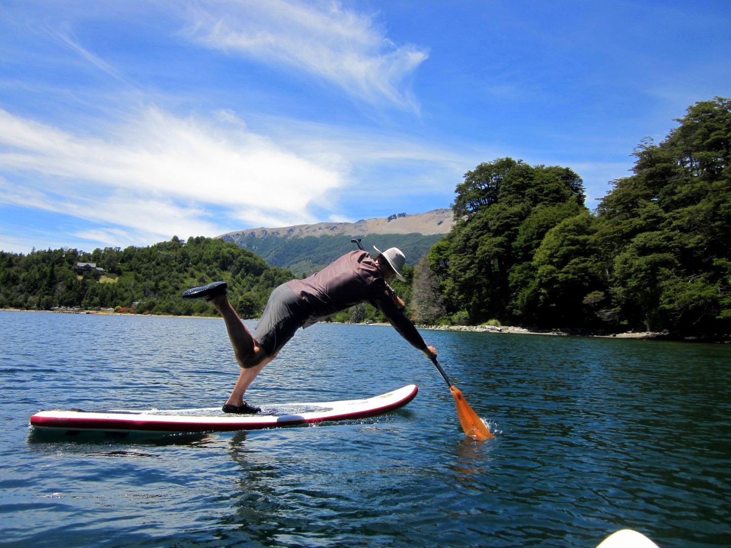
Further south, we settled for a night at Lago Hermoso ("Lake Beautiful"). It was so warm, we did some yoga on our paddleboards, knowing that a refreshing swim was guaranteed. Pictures below:


The area we were driving through is called "Siete Lagos" (Seven Lakes). There were definitely more than 7 lakes.  It's popular with hitchhiking backpackers and bikers because of all the campgrounds scattered along the beautiful lakes. Scott loved seeing so many backpackers carrying guitars with them. This is very unique to Argentina.

On our next stop, we camped near Lago Villarino and Lago Faulkner (so many lakes!). Here, we finally met fellow overlanders, Sam and Erica, from SongOfTheRoad.com (pictured below). We had really been hoping to cross paths with them. They are a smart and insightful couple who find adventure in places most people pass by. They have been on the road for almost 2 years. Like most of our run-ins with other travelers, the meeting was way too brief. We stayed up late sharing stories and having drinks before saying goodbye the next morning.

Camping on Lago Villarino:
Sam and Erica (left) inspired us to follow them through some tight trees, right down to the water for a great camp spot


Lago Faulkner:
While we hiked around the lake, the water was so clear that we could see GIANT trout from the trail 200' above the water

Above Lago Faulkner, the nondescript looking peak, Cerro Faulkner, made for a great, challenging climb. The ash on the top of the mountain was DEEP - like we were walking on a white sand beach. We later learned that a nearby volcano that erupted in 2011 (Volcan Puyehue), had rained 4 - 6 inches of ash all over the area. The ash cloud CIRCLED THE GLOBE  and caused flight cancellations in South Africa, Australia, and New Zealand. Wow.

The view from Cerro Faulkner:
We could see the extensive Lago Faulkner and even Lago Nuevo and Hua Hum in the distance


The view from Cerro Faulkner:
From the road, this peak is not interesting, but once on top, you realize there is color, texture, and lots of ash

Nearby, at a tiny lake called Lago Espejo Chico ("Little Mirror"), we broke the park-rules a couple times. The campground at this lake was officially closed, but we decided since we were just "parking", not "camping", we would try our luck. No loud neighbors, no smoky fires, and clear, starry-skies. We enjoyed it for 2 nights!

There was a small, crystal-clear, turquoise river draining Lago Espejo Chico that was just screaming for us to paddleboard it. We were pretty sure it was NOT allowed (given that there were two signs stating that it was NOT allowed). We suspect this rule is to avoid conflicts with fishermen. However, signs also said "Fly Fishing Only", and since half of the fishermen were breaking this rule, and we were already breaking the no-camping rule, we decided to go for it. After all, we hadn't seen a park ranger for days.


The river is the most beautiful, clear river we have ever paddled. We were only able to go a couple miles before we stopped above some un-scoutable rapids. We exited the water, rolled up our inflatable paddleboards, and stuffed them in our backpacks for the walk back to our truck. It was just our luck that a park ranger drove by while we were hoofing it down the road with our bright orange paddles in hand. He stopped and told us we could paddle on the lake, but NOT on the river. Since he hadn't actually caught us on the river, he could only slap us on the wrists. It was totally worth it, and only a few trout were disturbed, we promise.

This was just the beginning of the fun that we had in the region. Stay tuned for Part II