Friday, January 2, 2015

Araucaria Huggers

We have spent a lot of time in the spectacular national parks of Chile. Our $20/person annual pass for the national parks was the best thing we EVER purchased in Chile. It's paid for itself 5-fold and there are still lots of parks on our list. One of the more unique national parks was Parque Nacional Nahuelbuta, a sanctuary for the Araucaria tree. English speakers call them "Monkey Puzzle" trees but for some reason, I can't bring myself to call them that.

Puzzling a monkey

The Araucaria tree, an evergreen, and the national tree of Chile, is only found in the central region of the country. The trees were harvested almost to extinction, but are now protected throughout middle Chile and Argentina. They can grow up to 140 ft tall and reach 3000 years old. That's so old, I can't even wrap my mind around it. Can you imagine what some of these old trees have lived through? Just to put it in perspective, Christopher Columbus landed in the Americas 523 years ago.

Hugging an 1800 year-old Araucaria - E I G H T E E N  H U N D R E D!!!!!
(This tree was in Congillio National Park)

Wikipedia describes them as "tolerant of coastal salt spray, but do not tolerate exposure to pollution." Maybe we were Araucaria trees in a past life.

The bark of the mature trees is the oddest thing I've seen (though we did note that the really old trees seem to have lost their big puzzles pieces, like the 1800 year-old above):


We stayed a couple of nights in the national park, and each evening, we hiked up to a nearby lookout to watch the sunset over the ocean, 20 miles away. We watched the moon rise behind us, highlighting the lofty Araucaria trees.

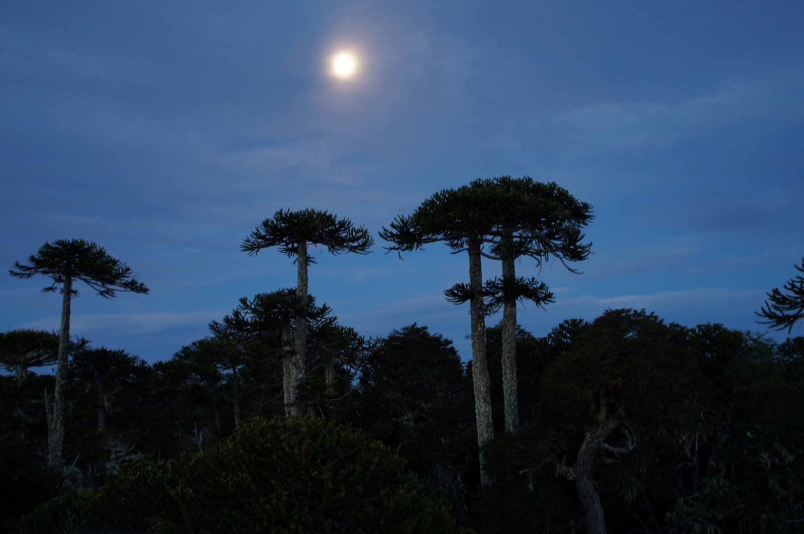

One night we hoofed our chairs, table, and dinner up to the lookout for a sunset dinner. That evening was really special, and it will stick in our memory for a long time.


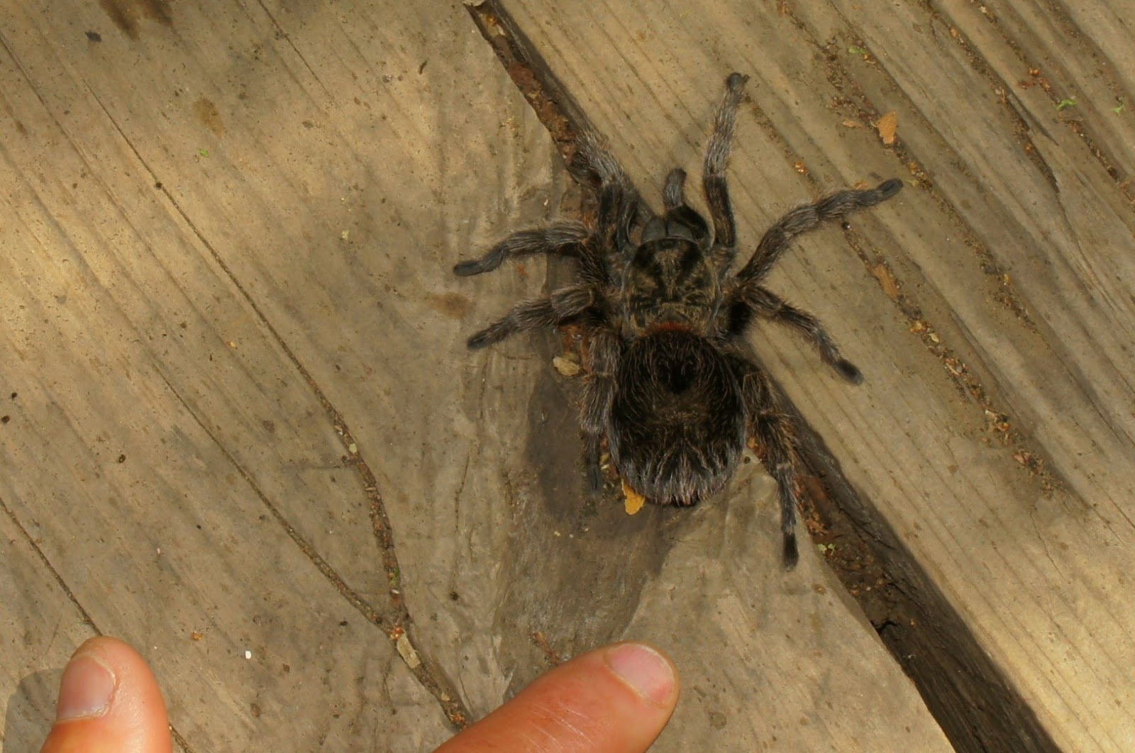
To add to the excitement, we had a furry visitor slowly amble across the rock outcrop to join our party (pictured below). We've since researched the Tarantula, and learned that they are mostly harmless. When threatened, they will flick their hairs at the offender. These hairs can really mess up an eye or respiratory tract.

They call these Tarantulas "politos"

We continue to see Araucaria trees throughout the national parks, but this park had the best collection of the old, giant ones. If you thought we were tree huggers before, we've taken it to a whole 'notha level.


Practical Information For Fellow Travelers

Access to Nahuelbuta:
There are low hanging branches throughout the park. We entered from Angol and asked the ranger about the road to Canete. He said we could not drive the road because it is narrow and there are many low hanging branches. Our truck is 2.7 meters tall.

Camping in Nahuelbuta:
We accessed the park at the beginning of Dec 2014. We parked/camped (for free) at the trailhead to Piedra del Aguila for 2 nights without a problem. Dare2go.com visiting during the high season in Jan 2015 and this was not allowed.

Hiking in Nahuelbuta:
The hike between the campground and Piedra del Aguila is the best of all the hikes for views and experiencing the large, old trees. The hiking trails are not well-signed.

Tuesday, December 9, 2014

U-Turn Border Run - Chile to Argentina

Coming up on the end of our 90-day visa in Chile, we studied the map trying to find the most logical pass to cross the Andes into Argentina. We had planned on driving back and forth across the border in one day to get another 90-day visa. Rather than being a chore, it turned out to be an amazing drive along the Rio Maule on a newly paved road. We ended up spending 5 days camping and exploring the uninhabited area.

For a few minutes, the Rio Maule looked like a lava flow

The only chore was paying our $160 (!) per person entry fee to Argentina while we were near internet. It's an odd process - you have to pay for your entry visa ONLINE, only online, and print the receipt before you cross. If you cross somewhere that offers no internet (like the border crossing we were heading to), you will be turned away.

Before we started the drive, we met a local guy who told us about a secret hot spring along a tributary to the Rio Maule. I was doubtful we would find it, but excited about the possibility. He gave us vague directions, but we were able to pinpoint a possible location with our GPS. We found the parking/camping spot and even found the trail up the river to the hot springs. One problem... the hot springs were across a swollen, raging river that we couldn't cross. We tried for 3 days to figure out how to get over to the hot springs. Everyday, they taunted us with their steamy pools.

Even though we couldn't reach the hot springs we got to enjoy an amazing camping spot right next to the river. The roar of the river lulled us to sleep each night (picture below).

Camping next to the Rio Maule near the Argentinian border

When we arrived to the Chilean border post (30 miles from the actual physical border), we told them our plans of  driving to Argentina and immediately returning - queremos recargar nuestros visas. The nice immigration official told us we didn't need to drive 60 miles to the Argentinian office, and that we could simply drive around the building to get our new 90-day Chilean visa and vehicle permit. That made our day! What a relief.

Interesting formations along the drive

We drove around the building and began the re-entry process (passport stamp, forms, declarations, etc., etc.). Chile is notorious for their over-the-top agricultural rules at the border - no food (beans, nuts, cheese, meat, fruits, veggies, pet food, spices, etc.). They ask you to declare any restriced items. We were a little confused about how to handle this since everything we had came from Chile, given that we had never left. Anyhow, we declared a few items just to not look suspicious - firewood Scott had cut 10 minutes prior, cabbage, and a few other things. Despite our many attempts to explain to the inspectors that W E  H A D  N E V E R  L E F T  T H E  C O U N T R Y, they still took our stuff. Oh well, at least they didn't find all the fresh fruits and veggies that I had hid throughout the truck - neener neener.

I guess we paid $320 entry into Argentina a little early. Good thing it lasts 10 years.

Sunday, December 7, 2014

Smiling in Middle Chile

I've always been really bad with world geography, but for as long as I can remember, I knew where Chile was, and had a vision for what the land must look like. The country spans the relatively small gap between the Pacific Ocean and the Andes mountains for nearly half of the South American continent. I had always envisioned Chile as this razor edge of a mountain range that fell precipitously into the ocean. That didn't exactly prove to be true, but on a grand scale, my vision certainly works. There are, in fact, stunning, precipitous mountains and massive rivers that pour into the Pacific. For the past month we've been exploring some of these regions.

We visited 3 national parks in the "middle Chile" region which doesn't get explored as much as the more famous Lakes District or Patgonia in the south. We were lucky to visit the region during a stretch of blaring, blue sky days and lots of spring snow melt. Lots of snow melt = big rivers and lakes = volumous waterfalls = greenery.

The first National Park was called Siete Tazas - literally, 7 cups [of water]. We found many more than 7 cups! The main river is called the Rio Claro (Clear River) which cuts through a narrow, basalt canyon. It's a famous river for kayakers looking for the thrill of narrow canyons and clean waterfalls.


The namesake of the park - Siete Tazas (7 cups)


We hiked to the base of this waterfall and Scott bravely took a dip - cold!

The water was so clear, and the air just hot enough, we couldn't resist swimming. When I jumped in, my chest tightened, and the icy-cold water took my breath away. Scott didn't have this reaction. He had many deliciously cold swims in the river during our exploration of the park. I was jealous, but wanted to avoid a heart attack, so I just took pictures.

JUMP!


Siete Tazas was the location of our first monster-bug sightings (see below).


Since spotting this tarantula, we've seen quite a few crossing the road while driving and many sunning themselves on the walking trails in the forest.

Next up was a national park, Lircay del Altos, which despite being only 12 miles away, took us 100 miles of driving to reach. The highlight was a hike just outside the park boundary that climbed to one of the taller peaks in the region, Cerro Peine (literally Comb Peak). Along the entire route, we could see mountains, volcanos, rivers, lakes, and at the top, even the ocean in an amazing 360 degree view. This hike ranks among our favorites ANYWHERE. Pictures below:

The view from our free camping spot in the parking lot at Lircay

Scott's favorite mountain in the park, that you could see from many viewpoints

A short walk from the access road took us to this lookout

On the snowy edge of Cerro Peine

Lost at the top of the mountain

Our next middle Chile national park was Laguna del Laja. There are many lagunas (lakes) in the area, but almost all of them are formed by hydroelectric dams, and thus have power lines and man-made infrastructure that takes away from the natural beauty. Laguna del Laja, on the other hand, was formed when the nearby volcano erupted, and lava dammed the river. Everywere you look, rivers and waterfalls are tumbling down the mountains to make a landing in the laguna and river (Rio Laja). We found one of our favorite camp spots here next to the laguna, parked amongst the lava rocks. For several days, we had the place all to ourselves. We hiked, paddleboarded, swam, hammocked, yoga'ed, read, got sunburned (Scott), and smiled... a lot. Middle Chile made us very happy. Picture overload below:

Our first camping stop in the park before getting to the Laguna del Laja

So many beautiful waterfalls on this wall we got a neck-ache during lunch

Laguna del Laja

Holding my nose

Header

Extreme hammocking


Wednesday, December 3, 2014

Finding Some Green in Middle Chile

We're officially a little more than halfway down the long ribbon of land known as Chile. After so many months in the dry, leafless desert of the north, we were looking forward to some softer surroundings. As soon as we were just a little bit north of Santiago, things started to change. Our first stop was a national park, La Campana, containing one of the last palm forests of the Chilean Wine Palm.

Driving up to La Campana National Park

These trees can live to be several hundred years old

A green (ish) lizard - we've finally left the desert!

La Campana's other claim to fame is the large mountain that Charles Darwin climbed in 1834. The steep trail climbs nearly 5000 vertical feet in just 5 km. At the top you can see the Andes mountains to the east and the Pacific to the west. Charles Darwin was one tough dude - the hike was a doozy.

Camping in the shadow of La Campana mountain, near a large Chilean Wine Palm

At La Campana you can hike to this lovely little waterfall set among the palms and cacti


Green yoga

South of Santiago, we worked our way down the coast surfing and kiteboarding a bit, but not as much as we had imagined we would. This area has some pretty famous surfing and kiteboarding spots, but we just weren't feelin' it. The winds were stronger than we would have liked and the water was a bit too cold for me.

The sand dunes at Topocalma - this place has some crazy strong winds 

We visited a famous surf spot that had very recently been inaccessible to all but small 4WD vehicles. A developer who had bought the land was tearing through the hillside making roads and home sites. The whole thing was really hard to watch, as the natural beauty of the area was being destroyed right before our eyes. The upside was that we got to use the new roads and even camp for free right at the surf break, while the developers were trying to figure out how to deal with everyone. The free-for-all camping only lasted 5 days before we were asked to leave. Once in a lifetime at Puertecillo...

The surf wave at Puertecillo

Puertecillo will never look like this again

Into the stunning mountains of middle Chile in the next blog post...